RTOPO Hydrology 3.4
- Buy $79
- Developer Link 1 (non https rcad.zip)
- Download3k US (rcad.zip)
- Download3k EU (rcad.zip)
MD5: ed57be04e5a1a25f3103083a40797893
All files are original. Download3K does not repack or modify downloads in any way. Check MD5 for confirmation.
Quick Review
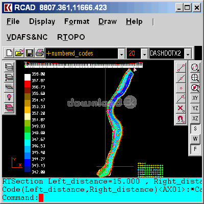
"Edit XYZ files; triangulation and isolines."
RTOPO is a simple and quite basic CAD software aimed at surveyors who don't need advanced features. Whilst the package doesn't look really pretty, it does include quite a few useful options. You can use isolines, triangulation, create contour maps, intersections, sections, and other specific aspects with a CAD drawing. It is possible to draw specific kinds of lines to reflect the type of topography needing to be indicated through the CAD drawing. Surveyors who conduct surveys of local areas, roads, possible areas of new development and such like will possibly find this application most useful for them; other people likely far less so.
RTOPO Key Features:
- CAD software that is aimed primarily at surveyors
- Create isolines, triangulation, create contour maps, intersections, and sections
- Draw out the local surveyed area for later review
RTOPO is a CAD package just really for surveyors.
Requirements: Graphic card with OpenGL hardware acceleration and 32-bit color depth
What's new in this version: 1 year subscription license
Antivirus information
-
Avast:
Clean -
Avira:
Clean -
Kaspersky:
Clean -
McAfee:
Clean -
NOD32:
Clean

Popular downloads in Photo & Graphic
-
 Bandicam Screen Recorder 8.3.1.2537
Best Game, Video, Screen Recording Software -
 PhotoScape 3.7
A fun and easy photo editing software. -
 Magic Photo Editor 7.5
Easilly blend photo onto another picture. -
 SketchUp Make 16.1.1450 32-bit / 17.2.2555 64-bit
An easy-to-learn 3D modeling program. -
 jAlbum 39.6
Highly customizable web galleries for any site. -
 Shipping Container House Plans 1.1
Shipping Container House Plans Software -
 Corel PaintShop Pro 2023 25.2.0.58 Update 2
All you need to create fantastic photos! -
 Just Color Picker 6.2
Free colour picker and colour-editing tool. - JR Split File 1.2
Split a large file into smaller files -
 progeCAD Smart! free DWG CAD 9.0.28.8
progeCAD Smart! free personal CAD software
-
OS
Win2000,WinXP,Win7 x32,Win7 x64,Windows 8,Windows 10,WinServer,WinOther,Windows2000,Windows2003,Wind -
License
Data Only -
Price
$79 Buy -
Updated
8/29/2025 -
Downloads
1606 (1 last week) -
Size
0.80 MB -
MD5
ed57be04e5a1a25f3103083a40797893 -
SHA1
7a2ca0aa11a45910243d5e6ca3d310329a46ec96 -
Developer
Rcad Software