AGIS for Windows 2002
Developed by AGIS Software Pty Ltd
-
Windows
-
setup file agis2002.exe (3.57 MB)
-
Shareware
Buy or select mirror:
- Buy $49
- Developer Link 1 (non https agis2002.exe)
- Download3k US (ver 2002, agis2002.exe)
- Download3k EU (ver 2002, agis2002.exe)
MD5: 4d31a6cf0bebc2e625bc84bbba399ba9
All files are original. Download3K does not repack or modify downloads in any way. Check MD5 for confirmation.
Developer Description
"Mapping and simple GIS tool."
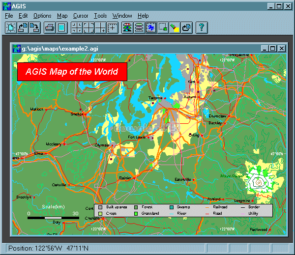
AGIS for Windows is a mapping and simple GIS shareware package. Plot your own geographic data on the map of the world provided without the high cost and steep learning curve usually associated with this kind of software. Create high resolution publication quality images that can be pasted into popular packages such as MS Word. Animation, web serving, distance measuring, searching, GPS and integration with other systems such as databases are also supported. Import MapInfo .mif/.mid, ARCInfo text .e00 and arc generate, South African national exchange standard and Garmin GPS track files. Tutorials and additional support are available from the web site.Requirements: 256 color display
Antivirus information
Download3K has downloaded and tested AGIS for Windows on 8 May 2012 with some of Today's best antivirus engines and you can find below, for your convenience, the scan results:
-
Avira:
Clean -
Kaspersky:
Clean -
NOD32:
Clean

Popular downloads in Photo & Graphic
-
 Bandicam Screen Recorder 8.3.1.2537
Best Game, Video, Screen Recording Software -
 PhotoScape 3.7
A fun and easy photo editing software. -
 Magic Photo Editor 7.5
Easilly blend photo onto another picture. -
 SketchUp Make 16.1.1450 32-bit / 17.2.2555 64-bit
An easy-to-learn 3D modeling program. -
 jAlbum 39.6
Highly customizable web galleries for any site. -
 Shipping Container House Plans 1.1
Shipping Container House Plans Software -
 Corel PaintShop Pro 2023 25.2.0.58 Update 2
All you need to create fantastic photos! -
 Just Color Picker 6.2
Free colour picker and colour-editing tool. - JR Split File 1.2
Split a large file into smaller files -
 progeCAD Smart! free DWG CAD 9.0.28.8
progeCAD Smart! free personal CAD software
User rating
0/5 (0 votes)
Your rating
-
OS
Win95,Win98,WinME,WinNT 3.x,WinNT 4.x,WinXP,Windows2000 -
License
Shareware -
Price
$49 Buy -
Updated
6/7/2012 -
Downloads
240 (1 last week) -
Size
3.57 MB -
MD5
4d31a6cf0bebc2e625bc84bbba399ba9 -
SHA1
9453e8609dcafe17e324f8d185dccb278573f7a1 -
Developer
AGIS Software Pty Ltd