OkMap Desktop 19.2.2
- Download3k US (ver 19.2.2, okmap.zip)
- Download3k EU (ver 19.2.2, okmap.zip)
MD5: cf52659aa26d139f91ae6aa9fa6de97e
All files are original. Download3K does not repack or modify downloads in any way. Check MD5 for confirmation.
Quick Review
""
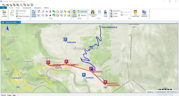
OkMap Desktop is a robust cartographic and GPS software for Windows that offers a variety of useful features for professional activities and outdoor sports enthusiasts. This software allows users to work on their computer screens with web maps or digital maps that they have either bought or scanned. OkMap can also import vectorial data from the most common formats and DEM data relevant to height information.
One of the key features of OkMap is the ability to download free maps from map servers, including Google, Apple, OpenStreetMap, ESRI, USGS, Kompass, and IGM, among others. Users can also georeference digital maps, create custom maps to use with their GPS or mobile device, and create tracks on the map with production of track statistics and track graphs. The software provides a navigation system based on offline maps or web maps with navigation tools such as a compass, and many other features.
Data collected by the user's GPS can be downloaded on their computer, stored, and displayed on the maps. They can also be used to create different types of statistics. By connecting a GPS to their laptop, users can plot their position on maps in real-time. If they are connected to the network, they can constantly send their position to a remote computer or receive the position of their companions on their computer and display the related tracks on maps in real-time.
OkMap can also interface with Google Maps and Google Earth. With Google Maps, users can view maps and data of their interest. With Google Earth, they can view their paths and their maps in 3D. The software includes a feature to generate automatically compatible Garmin Custom Maps (KMZ format) and maps in OruxMaps format. This feature includes map tiling from and to different image file formats (including ECW map format). It's possible to select KML extensions 2.2 (if GPS supports them), the JPEG quality, the image resizing, the KML transparency, the draw order, and so on. Users can also select the tiles to generate in output. This feature supports not north-oriented maps also.
OkMap has a database with about 700 datums and about 5000 predefined projections by geographic area. Users can view 3D raster maps on Google Earth (for supported image formats) and manage projects and map add-ons, such as icons and comments. The software supports vectorial data management (point, multipoint, line, polygon) and GPX data management (waypoints, tracks, routes).
OkMap is a versatile software that is useful for professional activities in the field, outdoor sports, and enjoyment in nature, such as search and rescue, trekking, mountain biking, 4WD, geocaching, and much more. The software has a variety of features to meet the needs of various users, including a dark theme, customizing toolbar, and the ability to show or hide the toolbar and status bar. With potential uses ranging from finding mushrooms to hunting and fishing, OkMap is a must-have tool for anyone who loves outdoor activities.
Antivirus information
-
Avast:
Clean -
Avira:
Clean -
Kaspersky:
Clean -
McAfee:
Clean -
NOD32:
Clean

Popular downloads in Home & Education
-
 Google Earth 7.3.6.10201
It's a globe that sits inside your PC. -
 JPEG Recovery Professional 6.2
Repair corrupted JPEG picture/photo -
 Alkitab Bible Study 6.1
Alkitab is a free desktop bible study tools. -
 Cleantouch Urdu Dictionary 7.0 7.0
English to Urdu & Urdu to English Dictionary -
 4.0.1003.8008 - Closer to knowing \"what it is like out there\"") Microsoft Bing Maps 3D (Virtual Earth 3D) 4.0.1003.8008
Microsoft Bing Maps 3D (Virtual Earth 3D) 4.0.1003.8008
Closer to knowing "what it is like out there" -
 WordWeb 8.1
Free English thesaurus and dictionary -
 Lal Kitab Explorer 1
Astrology software based on Lal Kitaab system -
 Learn To Speak Japanese 3.2
Improving Japanese and building vocabulary. -
 Kindle for PC 2.7.70978
Read Kindle books on your PC. -
 Mobipocket Reader Desktop 6.2
Organize, read and sync your eBooks & eNews.