OziPhotoTool 2.8
Developed by OziPhotoTool
-
Windows
-
setup file OziPhotoTool2_8jre.exe (19.82 MB)
-
Shareware
Buy or select mirror:
- Buy $25
- Developer Link 1 (non https OziPhotoTool2_8jre.exe)
- Download3k US (OziPhotoTool2_8jre.exe)
- Download3k EU (OziPhotoTool2_8jre.exe)
MD5: 84b01c745eda6ab47583da9b0e19497c
All files are original. Download3K does not repack or modify downloads in any way. Check MD5 for confirmation.
Developer Description
"Automatically locates photos with GPS info."
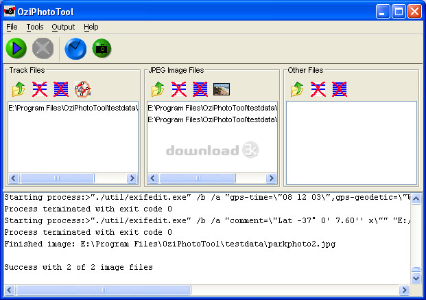
OziPhotoTool combines the technology of a GPS receiver and a digital camera to automatically keep a record of where digital photos were taken. It is designed to be used in conjunction with OziExplorer. Most digital cameras have EXIF metadata stored as part of the photo. This includes is the date and time the photo was taken. Many GPS units have 'tracklogs'. The GPS keeps a record of points that the unit has traveled over, including the time at each point. OziExplorer can read tracks from many different GPS units. OziPhotoTool takes the digital photos with EXIF metatdata, and tracks from OziExplorer to determine where the GPS was when the photo was taken. As long as the GPS was in the same location as the camera this represents the location of the photo. OziPhotoTool outputs the linkage between the photo and its location by creating an OziExplorer waypoint file, generating map features on OziExplorer maps, watermarking the photos, embedding exif information in the photos, generating HTML output or generating Google Earth kml/kmz files. Check http://www.oziphototool.com/download.html for smaller download optionsRequirements: 128M RAM
What's new in this version: Performance and stability update
Antivirus information
Download3K has downloaded and tested OziPhotoTool on 6 May 2012 with some of Today's best antivirus engines and you can find below, for your convenience, the scan results:
-
Avira:
Clean -
Kaspersky:
Clean -
NOD32:
Clean

Popular downloads in System Utilities
-
 Realtek AC'97 Drivers A4.06
Realtek AC 97 sound driver. -
 32-bit & 64-bit (KB976932) - The first service pack for Windows 7.") Windows 7 Service Pack 1 (SP1) 32-bit & 64-bit (KB976932)
Windows 7 Service Pack 1 (SP1) 32-bit & 64-bit (KB976932)
The first service pack for Windows 7. -
 Realtek High Definition Audio Driver for Vista, Win7, Win8, Win8.1, Win10 32-bit R2.82
High definition audio driver from Realtek. -
 .NET Framework 2.0
The programming model of the .NET -
 Driver Cleaner Professional 1.5
Improved version of Driver Cleaner -
 RockXP 4.0
Allows you to change your XP product key -
 Realtek AC'97 Drivers for Vista/Win7 6305
Multi-channel audio CODEC designed for PC. -
 DAEMON Tools Lite 12.3.0.2297
The FREE Virtual CD/DVD-ROM-EMULATOR. -
 AutoCorect 4.1.5
Diacritice la comanda, punctuatie automata. -
 SIW 16.09.0628
SIW - System Information for Windows
User rating
0/5 (0 votes)
Your rating
-
OS
Win98,WinME,WinXP,Windows2000,Windows Vista -
License
Shareware -
Price
$25 Buy -
Updated
10/1/2009 -
Downloads
224 (1 last week) -
Size
19.82 MB -
MD5
84b01c745eda6ab47583da9b0e19497c -
SHA1
3024013993e6dc86454a4caf5367b27f282b7ba3 -
Developer
OziPhotoTool