PhotoGPSEditor 1.6
Developed by MMISoftware
-
Mac OS
-
setup file photogpseditor.dmg (2.39 MB)
-
Freeware
Select a download mirror:
- Developer Link 1 (non https photogpseditor.dmg)
- Download3k US (photogpseditor.dmg)
- Download3k EU (photogpseditor.dmg)
MD5: f1537aa65dd34b951c14b2368d347f80
All files are original. Download3K does not repack or modify downloads in any way. Check MD5 for confirmation.
Developer Description
"Add and edits photo meta-data using GPS data"
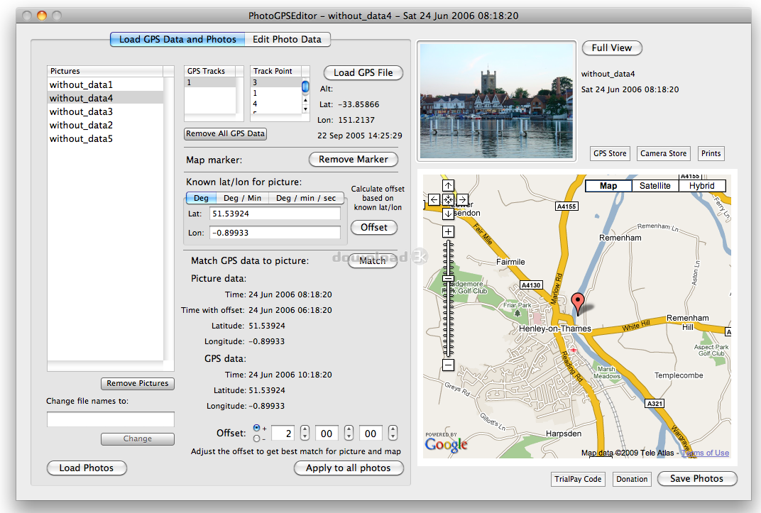
PhotoGPSEditor is an easy to use meta-data editor for photo (JPEG, RAW) files, plus it can match data from GPS (gpx or NMEA) files. The program is freeware, however, donations can be made to help support future development. With PhotoGPSEditor you can add location and summary details to a JPEG/RAW photo files. Location information consists of latitude and longitude data, as well as town, area/region, and country. This can be added automatically by matching up photos with GPS (gpx or NMEA) file track data, manually (just type it in) or 'automatically' by placing a pointer on a map to get the latitude and longitude data. The program can then add town, area/region, and country information. This process can also be described as 'geocoding' a picture/photoRequirements: Mac OS 10.5 and above
What's new in this version: Updated for Mac 10.6 Snow Leopard
Antivirus information
Download3K has downloaded and tested PhotoGPSEditor on 28 May 2012 with some of Today's best antivirus engines and you can find below, for your convenience, the scan results:
-
Avira:
Clean -
Kaspersky:
Clean -
NOD32:
Clean

Popular downloads in Photo & Graphic
-
 Bandicam Screen Recorder 8.3.1.2537
Best Game, Video, Screen Recording Software -
 PhotoScape 3.7
A fun and easy photo editing software. -
 Magic Photo Editor 7.5
Easilly blend photo onto another picture. -
 SketchUp Make 16.1.1450 32-bit / 17.2.2555 64-bit
An easy-to-learn 3D modeling program. -
 jAlbum 39.6
Highly customizable web galleries for any site. -
 Shipping Container House Plans 1.1
Shipping Container House Plans Software -
 Corel PaintShop Pro 2023 25.2.0.58 Update 2
All you need to create fantastic photos! -
 Just Color Picker 6.2
Free colour picker and colour-editing tool. - JR Split File 1.2
Split a large file into smaller files -
 progeCAD Smart! free DWG CAD 9.0.28.8
progeCAD Smart! free personal CAD software
User rating
0/5 (1 votes)
Bad
Your rating
-
OS
Mac OS X -
License
Freeware -
Price
$0 -
Updated
9/24/2011 -
Downloads
200 (6 last week) -
Size
2.39 MB -
MD5
f1537aa65dd34b951c14b2368d347f80 -
SHA1
118ecedc3313b69cf9025e3eee775951a4cd45ec -
Developer
MMISoftware